Perth Airport Western Australia Street Map
Home > Australian Maps > Western Australia > Perth Airport WA Street Map
Perth
Perth is the capital city of the state of Western Australia. It is located on the country's western coast, along the shores of the Indian Ocean. Perth is known for its stunning beaches, expansive parks, thriving arts scene, and laid-back lifestyle.
Perth enjoys a Mediterranean climate with hot, dry summers and mild winters. The city experiences abundant sunshine throughout the year, making it an ideal destination for outdoor activities and beach lovers.
The cityscape of Perth features a mix of modern architecture, historic buildings, and well-maintained parks and gardens. The Swan River flows through the city, offering scenic views and recreational opportunities such as boating and riverside walks.
Perth is renowned for its beautiful beaches. Cottesloe Beach, Scarborough Beach, and City Beach are popular spots for swimming, sunbathing, and water sports. Rottnest Island, located just off the coast, is a popular getaway known for its pristine beaches, turquoise waters, and unique wildlife, including the adorable quokkas.
The city has a vibrant arts and cultural scene. It is home to numerous art galleries, museums, and theatres. The Perth Cultural Centre is a hub for arts and entertainment, housing the Art Gallery of Western Australia, the State Library, the Western Australian Museum, and the Perth Institute of Contemporary Arts.
Perth hosts various cultural festivals and events throughout the year, including the Perth Festival, which showcases performing arts, music, and visual arts. The city is also known for its live music scene, with numerous venues offering a wide range of genres.
Perth has a burgeoning food and wine scene, with an emphasis on fresh local produce and diverse cuisines. The city's dining precincts, such as Northbridge, Subiaco, and Fremantle, offer a plethora of restaurants, cafes, and bars catering to different tastes and budgets.
Perth is an ideal base for exploring Western Australia's natural wonders. The state boasts stunning landscapes, including the iconic Pinnacles Desert, the rugged coastline of Margaret River, and the breathtaking gorges of Karijini National Park. The region is also known for its world-class wineries, offering wine-tasting tours and gourmet experiences.
With a population of around 2 million people, Perth has a relaxed and friendly atmosphere. The city offers a high standard of living, excellent educational institutions, and a strong economy driven by sectors such as mining, energy, technology, and tourism.
In summary, Perth is a vibrant city known for its beautiful beaches, outdoor lifestyle, thriving arts scene, and proximity to Western Australia's natural wonders. It offers a balance between urban amenities and access to stunning landscapes, making it an attractive destination for visitors and a desirable place to live.
Welcome to our Perth Airport, Western Australia Street map page. The street map of Perth Airport WA that is located below is provided by Google Maps. You can "grab" the Perth Airport WA street map and move it around to re-centre the map. You can change between standard map view and satellite map view using the small square on the bottom left hand corner of the map. Satellite map view utilizes orbiting satellite or aerial high resolution photography to display images of the map location to street level detail (really quite amazing). Standard map view shows a traditional street map sometimes called a road map. You can use the zoom buttons on the bottom right hand side of the map to zoom in or out to street level detail. We have maps for most Australian towns and cities, so click on the Australian Maps link to see more Australian maps.
I hope you like the Perth Airport, WA, Australia street map / road map situated above.
If you like our website, please consider adding a link to the site. These links help to build website traffic and they are considered a vote of confidence for a site.
I can still feel the heat of the Australian sun as I travelled with my father, visiting Adelaide, Brisbane, Canberra, Melbourne, Sydney, and the Gold and Sunshine Coasts. The sights were breathtaking, ranging from lush greenery to arid landscapes inspiring a feeling of wonderment — until we visited the Hunter Valley wine region. With its exquisite selection of wines, it urged us to imbibe and explore even further. We stayed in Kings Cross, providing us with easy access to Manly Beach and the Sydney CBD and we visited the Sydney Motorshow admiring the supercars. The air was alive with the energy of thousands of passionate fans, all coming together to watch a truly titanic battle between the Kiwi League Team and the Australians at the Olympic Stadium in Sydney. We felt every hit, every near miss, and every moment of glory as we watched them fight for victory. We visited the Blue Mountains in NSW and experienced all that nature offered us; from towering peaks to the magnificent eucalyptus forests covered in a shimmering blue haze. We caught a magical ferry to Kangaroo Island, where the scenery took our breath away. Every rock formation was an awe-inspiring work of art — a masterpiece carved out by nature. We felt like we were in a dream world, and never wanted it to end. We were pelted with rain and hail in the humid subtropical climate of New South Wales. We braved the depths of a gold mine — artistic license — in Ballarat and beheld the astounding Twelve Apostles, standing proud by the tumultuous waters of the Great Ocean Road in Victoria. With each awe-inspiring wave that crashed against the majestic cliff faces, we felt a sense of wonder washing over us. We roared through the wilderness of the Glass House Mountains located in the Sunshine Coast Region of Queensland. We stayed in St Kilda in Melbourne and we visited the National Gallery of Victoria and admired the venerable Flinders Street Railway Station. The Gold Coast was truly magical with its golden-white sandy beaches and dazzling ocean vistas that will forever be etched into my memory.
City Maps
State Maps
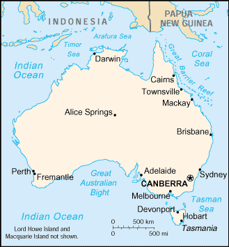
A Map of Australia