Australian Capital Territory Road Network Maps
Home > Australian Maps > Australian Capital Territory Road Maps
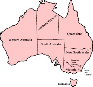
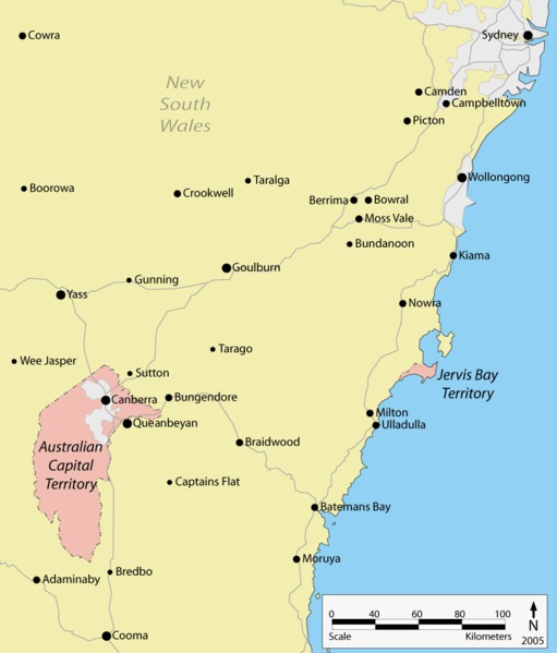
Australian Capital Territory
The Australian Capital Territory (ACT) is a federal territory located in southeastern Australia. It is an inland enclave surrounded by the state of New South Wales. The ACT serves as the administrative centre of the Australian government and is home to the nation's capital city, Canberra.
Canberra, located within the ACT, was purpose-built as the capital of Australia and officially became the national capital in 1913. It was designed by American architect Walter Burley Griffin who won an international competition to create the city's layout. The plans for Canberra were drawn by his wife Marion Mahony Griffin. The design incorporates geometric patterns, expansive parklands, and an emphasis on the natural landscape.
As the seat of the Australian government, the ACT is home to the Parliament House, where the country's federal legislature convenes. Other important government institutions, such as the High Court of Australia, the Prime Minister's residence (The Lodge), and numerous government departments, are also located in Canberra.
Canberra is known for its well-planned layout and spacious design. The city is divided into several districts, each with its own unique character. The city centre, known as Civic, features a vibrant mix of government buildings, shopping precincts, restaurants, and cultural institutions. The lakefront area, created by the damming of the Molonglo River, offers recreational activities such as boating, kayaking, and cycling.
The ACT is also home to an array of cultural and educational institutions. The National Gallery of Australia, the Australian War Memorial, the National Museum of Australia, and the National Library of Australia are among the prominent cultural attractions in Canberra. The city also hosts numerous festivals and events throughout the year, showcasing arts, music, food, and wine.
The natural beauty surrounding the ACT is another notable aspect of the region. The territory is nestled in the foothills of the Australian Alps, and the Brindabella Ranges provide a picturesque backdrop. Canberra is known for its abundance of parks, gardens, and nature reserves, including the iconic Australian National Botanic Gardens and the Tidbinbilla Nature Reserve, where visitors can encounter native wildlife.
Education is a significant industry in the ACT, with several universities, including the Australian National University (ANU), offering a wide range of academic programs. The ANU is highly regarded both nationally and internationally and contributes to the vibrant intellectual and research community in Canberra.
The population of the ACT is diverse, comprising people from various cultural backgrounds who have migrated to Canberra for employment opportunities and the high quality of life it offers. The territory has a high standard of living, with a strong emphasis on education, healthcare, and public amenities.
In summary, the Australian Capital Territory (ACT) is a federal territory located in southeastern Australia. It is home to the national capital, Canberra, which serves as the administrative and political centre of the country. Known for its well-planned layout, cultural institutions, natural beauty, and high standard of living, the ACT offers a unique blend of government, culture, and natural attractions.
Welcome to our Australian Capital Territory road map page. The map of the Australian Capital Territory that is located below is provided by Google Maps. You can "grab" the Australian Capital Territory road map and move it around to re-centre the map. You can change between standard map view and satellite map view. You can also use the zoom bar to zoom in or out. You can use the search form above the map to search for any location on.
I hope you like the Australian Capital Territory, ACT, AU street map / road map situated above.
If you like our website, please consider adding a link to the site. These links help to build website traffic and they are considered a vote of confidence for a site.
City Maps
State Maps
Australian Capital Territory ACT Map
From Wikipedia, the free encyclopaedia
Maps of Australian Capital Territory (ACT)
A
B
C
D
E
F
G
H
I
J
K
L
M
N
O
P
Q
R
S
T
U
V
W
X
Y
Z
Map of Australian States and Territories