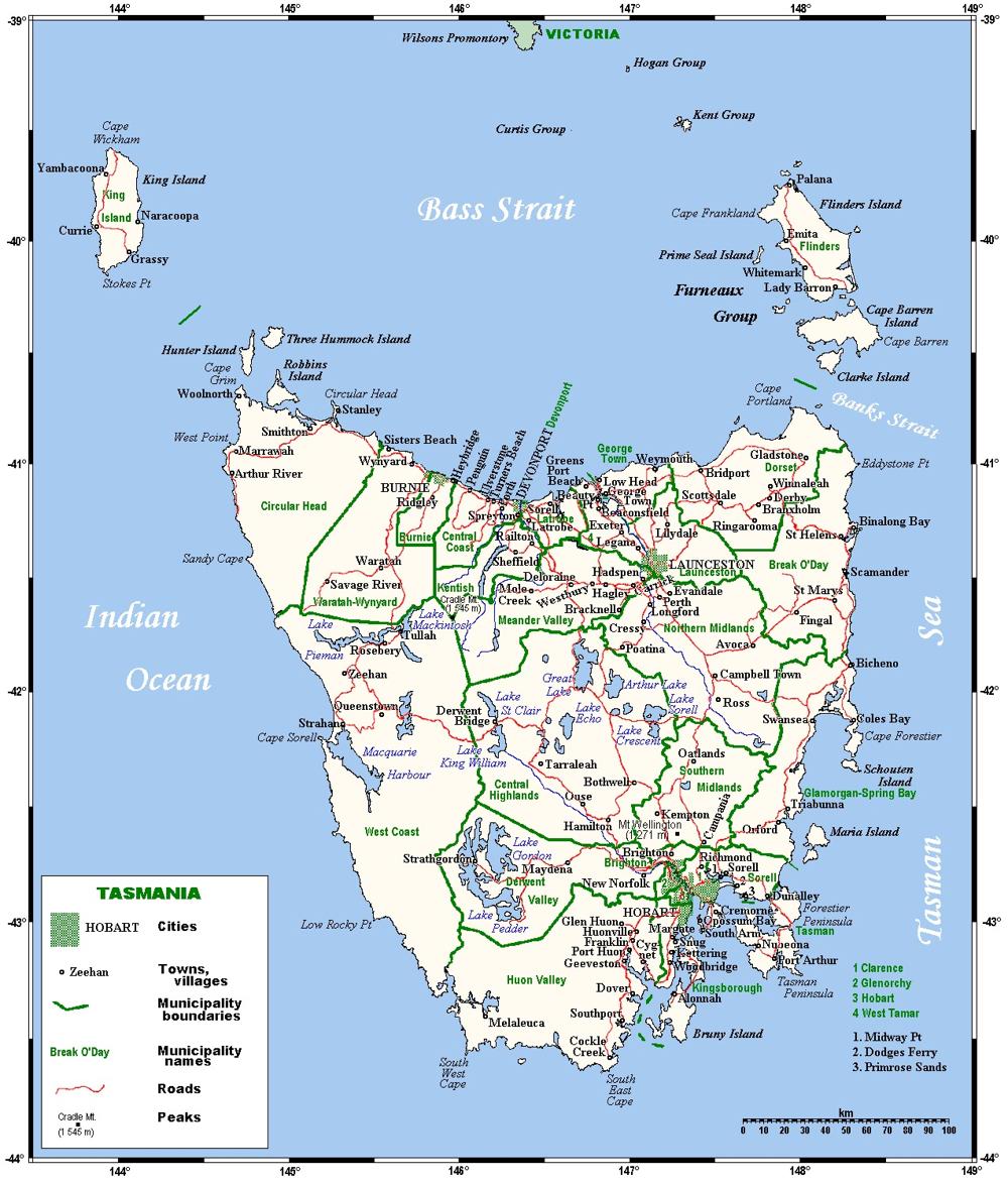
Tasmania Australia Road Network Maps
Home > Australian Maps > Tasmania Road Maps
Tasmania
Tasmania is an island state of Australia, located approximately 240 kilometres (150 miles) south of the mainland continent. It is the 26th largest island in the world and covers an area of about 68,401 square kilometres (26,410 square miles). Tasmania is separated from mainland Australia by the Bass Strait.
The capital and largest city of Tasmania is Hobart, which is situated in the southeastern part of the island. Other major cities include Launceston and Devonport in the north of Tasmania. Tasmania has a population of around 571,517 people.
Tasmania is known for its stunning natural landscapes and wilderness areas. A large percentage of the island is reserved as national parks and World Heritage Sites. The Tasmanian Wilderness World Heritage Area is a group of parks and reserves, which covers a significant portion of southwestern Tasmania and includes diverse ecosystems, ancient forests, and unique flora and fauna.
The island's geography is characterized by mountains, including the highest peak, Mount Ossa, which stands at 1,614 meters above sea level. Tasmania also features beautiful coastal areas, pristine beaches, rugged cliffs, and picturesque bays. The iconic Cradle Mountain-Lake St Clair National Park and Freycinet National Park are among the popular tourist destinations.
Tasmania has a cool temperate climate, with mild summers and cool winters. The island experiences a high level of rainfall, contributing to its lush vegetation and abundant wildlife. The native fauna of Tasmania is diverse, with notable species such as the Tasmanian devil, pademelons, quolls, wombats, and a variety of bird species.
The economy of Tasmania is based on a mix of industries. Agriculture plays a significant role, with dairy farming, wool production, and viticulture being important sectors. Tasmania is also known for its high-quality seafood, including salmon and crayfish. The state has a growing tourism industry, attracting visitors with its natural beauty, outdoor activities, and cultural attractions.
In terms of culture, Tasmania has a rich heritage influenced by its Aboriginal history, early European settlements, and convict past. The Port Arthur Historic Site, a former penal colony, is a UNESCO World Heritage Site and a popular tourist attraction that provides insights into Tasmania's convict history.
Overall, Tasmania offers a unique blend of stunning landscapes, rich biodiversity, outdoor adventures, and cultural heritage, making it a captivating destination for nature lovers and history enthusiasts alike.
Welcome to our Tasmania Australia road map page. The map of Tasmania Australia that is located below is provided by Google Maps. You can "grab" the Tasmania Australia road map and move it around to re-centre the map. You can change between standard map view and satellite map view using the small square on the bottom left hand corner of the map. Satellite map view utilizes orbiting satellite or aerial high resolution photography to display images of the map location to street level detail (really quite amazing). Standard map view shows a traditional street map sometimes called a road map. You can use the zoom buttons on the bottom right hand side of the map to zoom in or out to street level detail. We have maps for most Australian towns and cities, so click on the Australian Maps link to see more Australian maps.
I hope you like the Tasmania, TAS, AU street map / road map situated above.
If you like our website, please consider adding a link to the site. These links help to build website traffic and they are considered a vote of confidence for a site.
City Maps
State Maps
Tasmania Australia Road Network Map
From Wikipedia, the free encyclopaedia
Maps of Tasmania Australia (TAS)
A
B
C
D
E
F
G
H
I
J
K
L
M
N
O
P
Q
R
S
T
U
V
W
X
Y
Z
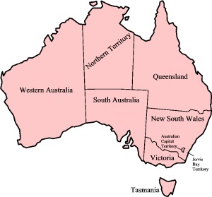
Map of Australian States and Territories